SkyMira offers GPS tracking through its hosted web portal and can stream GPS reports directly into your Computer Aided Dispatch (CAD) system. We also help you connect people to equipment and applications with IsatData Pro (IDP), the fastest low-data rate satellite communications service currently available. These capabilities enhance communications for workers in the field and are especially useful for fighting wildland fires.
Overview – SkyMira’s GPS Tracking Systems
Advanced asset tracking is one of the most important requirements of dispatch systems that GPS tracking provides. This capability monitors the exact location of assets on a map in real-time, including breadcrumb reports and historical information. It also offers real-time alerts for specific events (such as speeding) via email or SMS.
SkyMira’s GPS tracking includes the ability to create geofences, which are circular or polygon-shaped areas that you can assign to groups or individuals. Vehicles can send a real-time alert when geofence-related events occur, such as when a vehicle remains within a geofence longer than a pre-configured threshold. You can also receive detailed reports on entry, exit, and dwelling times inside a given area. Additional reports on the health of individual vehicles are available, including performance and schedules for preventative maintenance.
By integrating your GPS tracking with a Garmin Navigation system, you can communicate with drivers via text message. This allows you to check stop status and assign new tasks. Plus, drivers can send a panic alert in the event of thefts or hijackings, allowing you to immobilize a vehicle by remote control.
IsatData Pro
IDP network services are available from Orbcomm, which Skymira has offered for over a decade. Orbcomm provides dual-mode fleet tracking that operates over satellite and cellular networks. This is ideal for Internet of Things (IoT) applications, vehicle telematics, and environmental monitoring. IDP services also support Supervisory Control and Data Acquisition (SCADA) architectures that combine computers and network communications with a graphical user interface (GUI). SCADA uses peripheral devices like proportional-integral-derivative controllers (PID) and programmable logic controllers (PLC).
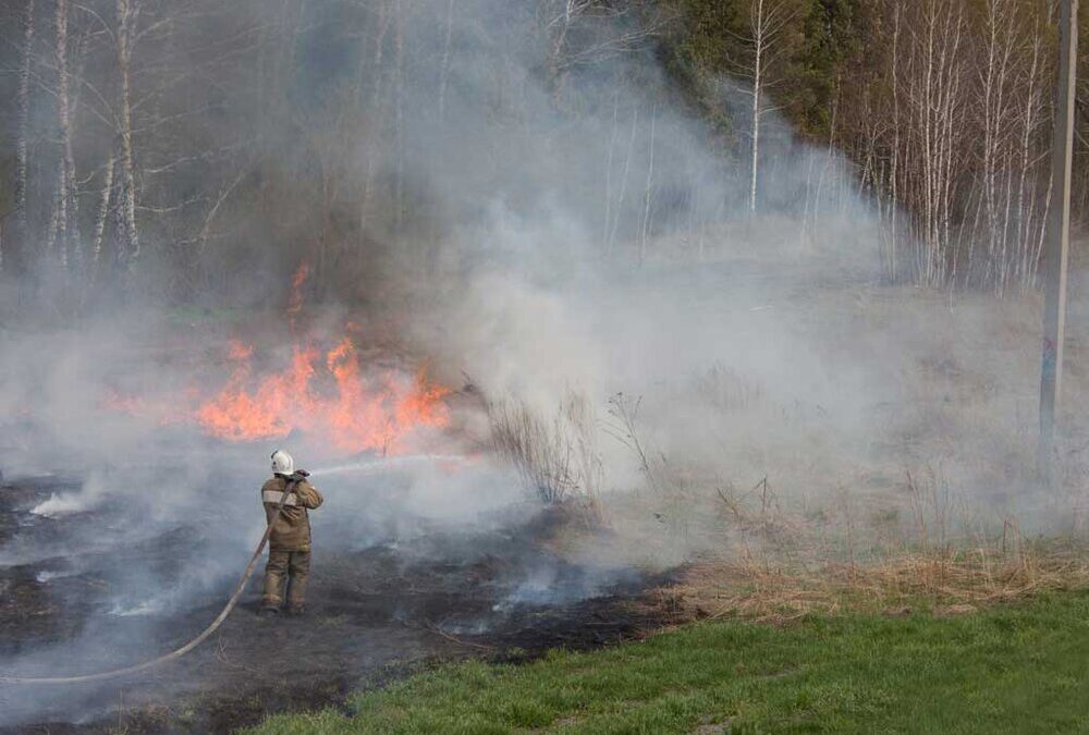
The Wildland Fire Act
Under the John D. Dingell, Jr. Conservation, Management, and Recreation Act of 2019, (commonly known as the Wildland Fire Act), fighting wildfires will receive higher priority. This law provides greater protection for public lands and substantially changes the provisions for their management. For example, the Wildland Fire Act designates over 1.3 million acres as wilderness areas, expands several national parks, and establishes four new national monuments. It also includes regulations to promote the use of technology in fighting wildfires. For example, firefighting agencies must begin using tracking systems to monitor team members and fire resources.
SkyMira’s GPS tracking is particularly useful for fighting wildland fires, as it can help fire captains locate team members, monitor vehicle conditions, and more. For example, a captain can set a geofence around an existing fire. If a vehicle remains inside the area for too long, the captain will be notified, and can then dispatch assistance.
Improve Safety & Enhance Communication with GPS Tracking from SkyMira
Our GPS tracking services offer a number of benefits for organizations with remote operations, including the ability to track the location and behavior of equipment and workers. These services will be especially helpful for firefighting agencies, which will need to ramp up their technology use under the Wildland Fire Act.
For more information about the benefits and applications of GPS tracking, contact SkyMira today!